Vice City vs Miami: 17 real locations in GTA 6
Start at Ocean Beach and follow the coast out to the Keys. For each of the 17 comparisons, look at the game image and the real-world photograph, then check the caption for what lines up.
Locations
17 pairs on the Florida map
Overview map by promptowy.com. Real-world locations plotted by coordinates; Miami inset is schematic. Number links to comparison.
- 01Ocean Beach and the Dixon HotelOcean Drive and the Hotel Victor
- 02Ocean BeachSouth Beach
- 03Beachfront pool deckFontainebleau Miami Beach
- 04Vice City skylineDowntown Miami
- 05Vice City at nightBrickell and Downtown Miami at night
- 06Megamundo skyscraperOne Biscayne Tower
- 07Sahara Arena and Ferris wheelKaseya Center and Skyviews Miami
- 08Stockyards muralsWynwood Walls
- 09Mansion islandsVenetian Islands and Venetian Causeway
- 10VCIA AirportMiami International Airport
- 11Leonida Keys bridgeSeven Mile Bridge
- 12Island highwayOverseas Highway and historic railway bridges
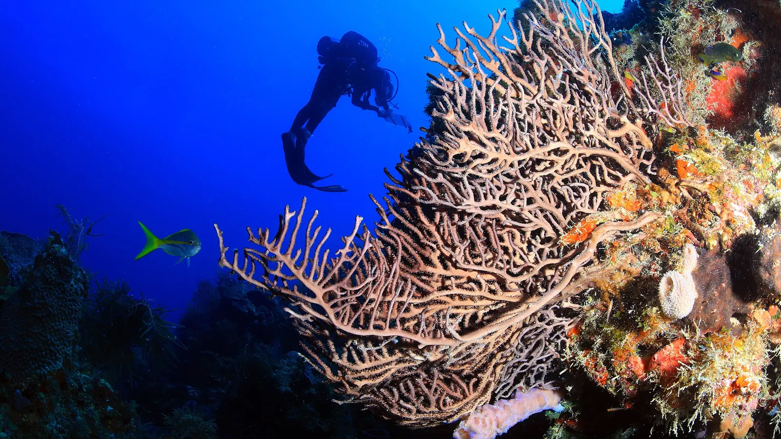
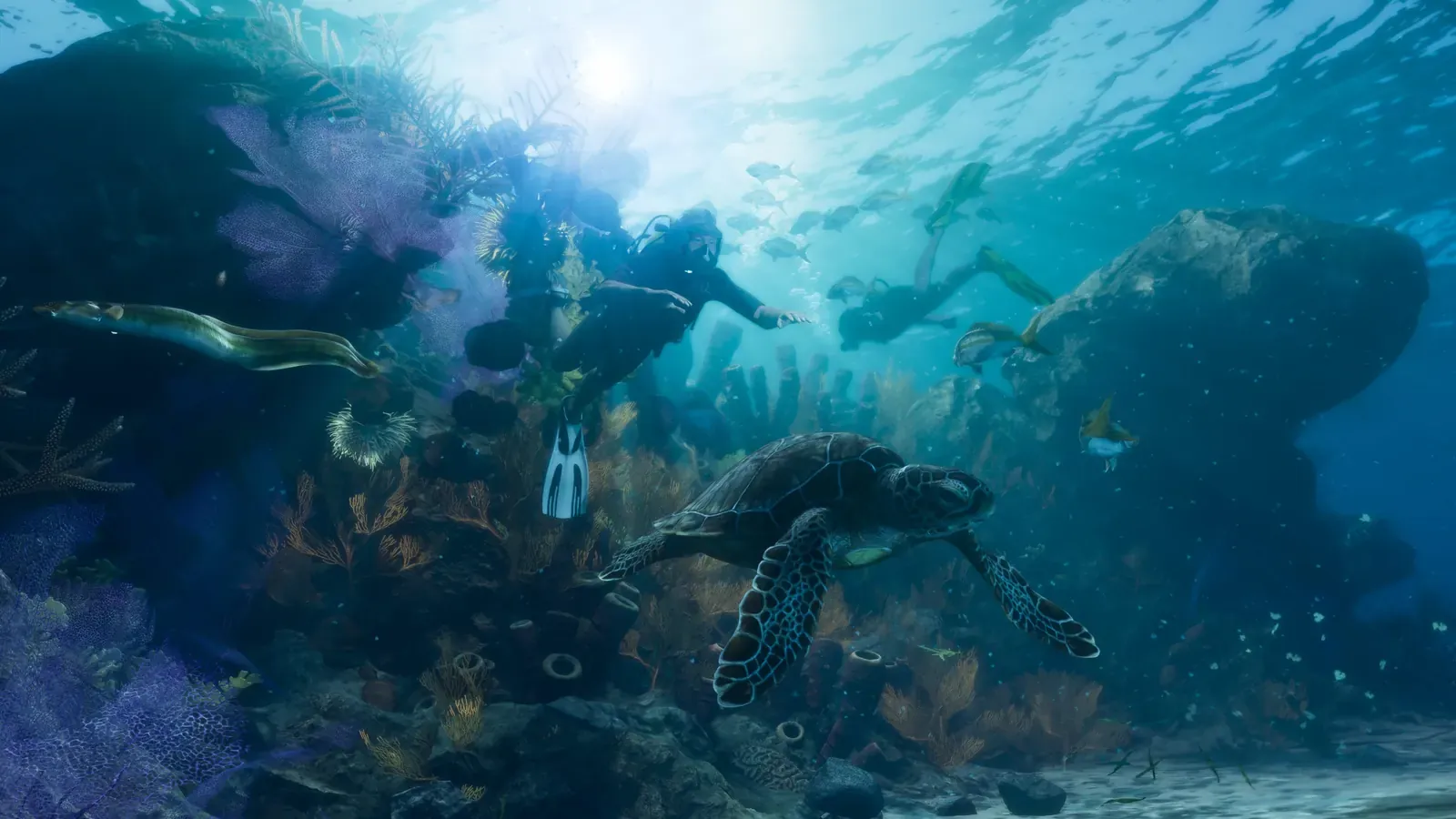
- 13Leonida Keys reefsFlorida Reef
- 14GrassriversEverglades
- 15Ambrosia and the Allied Crystal refineryClewiston and the U.S. Sugar refinery
- 16Port GellhornPanama City and the Panhandle coast
- 17Mount Kalaga National ParkProvidence Canyon
Vice City
Miami & Miami Beach - 10 pairs
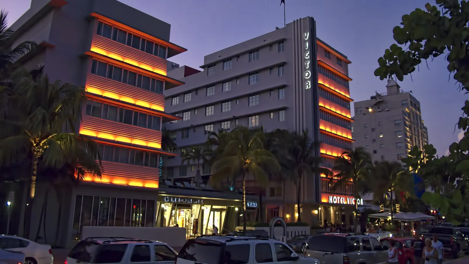
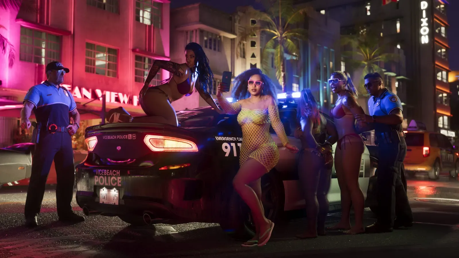
Left: Artwork: Rockstar Games. Right: Photo: Dan Lundberg, CC BY-SA 2.0, Wikimedia Commons.
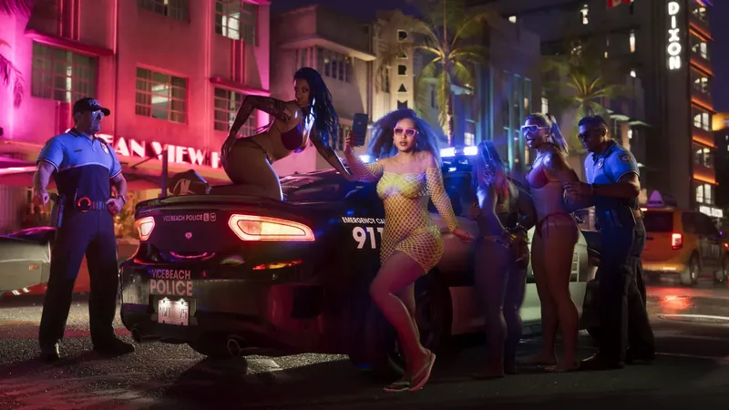
01Vice City
Ocean Beach and the Dixon HotelOcean Drive and the Hotel Victor
1144 Ocean Drive, Miami Beach
Ocean Drive is Miami Beach's most iconic strip: a row of pastel 1930s Art Deco hotels with neon signs, facing the park and beach. Hotel Victor is located at 1144.
Rockstar's TakeIn the game, the street was placed in the Ocean Beach district, and the hotels were given new signs. Victor's vertical neon sign became Dixon, and the Hotel Breakwater turned into the Hotel Boardwalk. Rockstar condensed the buildings and added more palm trees, making the street look denser than it actually is.
Confirmation: Miami New Times, GTABase.
Left: Artwork: Rockstar Games. Right: Photo: Gzzz, CC BY-SA 4.0, Wikimedia Commons.
02Vice City
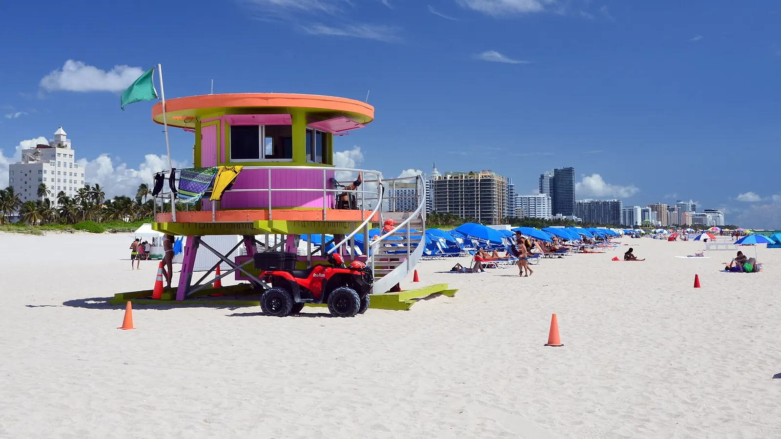
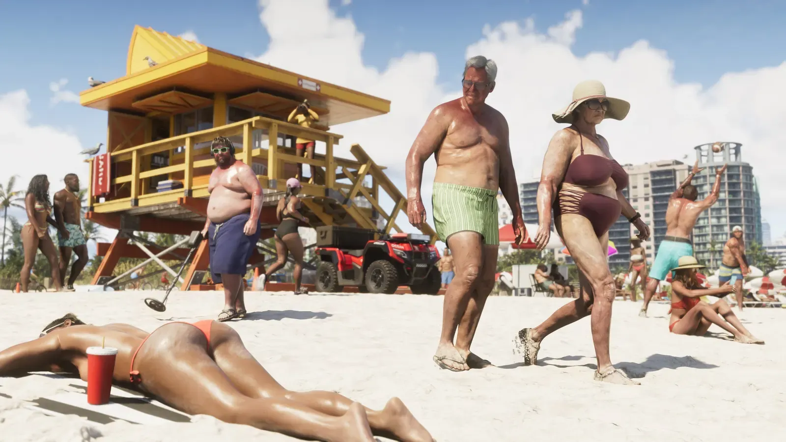
Ocean BeachSouth Beach
beach along Ocean Drive, Miami Beach
South Beach is the southern tip of Miami Beach featuring a wide sandy shore. Its signature trademark is the colorful wooden lifeguard towers, each with a unique shape and paint job.
Rockstar's TakeRockstar recreated the beach almost 1:1: the stilt-mounted tower, the lifeguard ATV beside it, and the wall of apartment high-rises in the background. The beach crowd, however, is the series' classic caricature of Florida.
Confirmation: GTABase.
Left: Artwork: Rockstar Games. Right: Photo: InvadingInvader, CC BY 4.0, Wikimedia Commons.
03Vice City
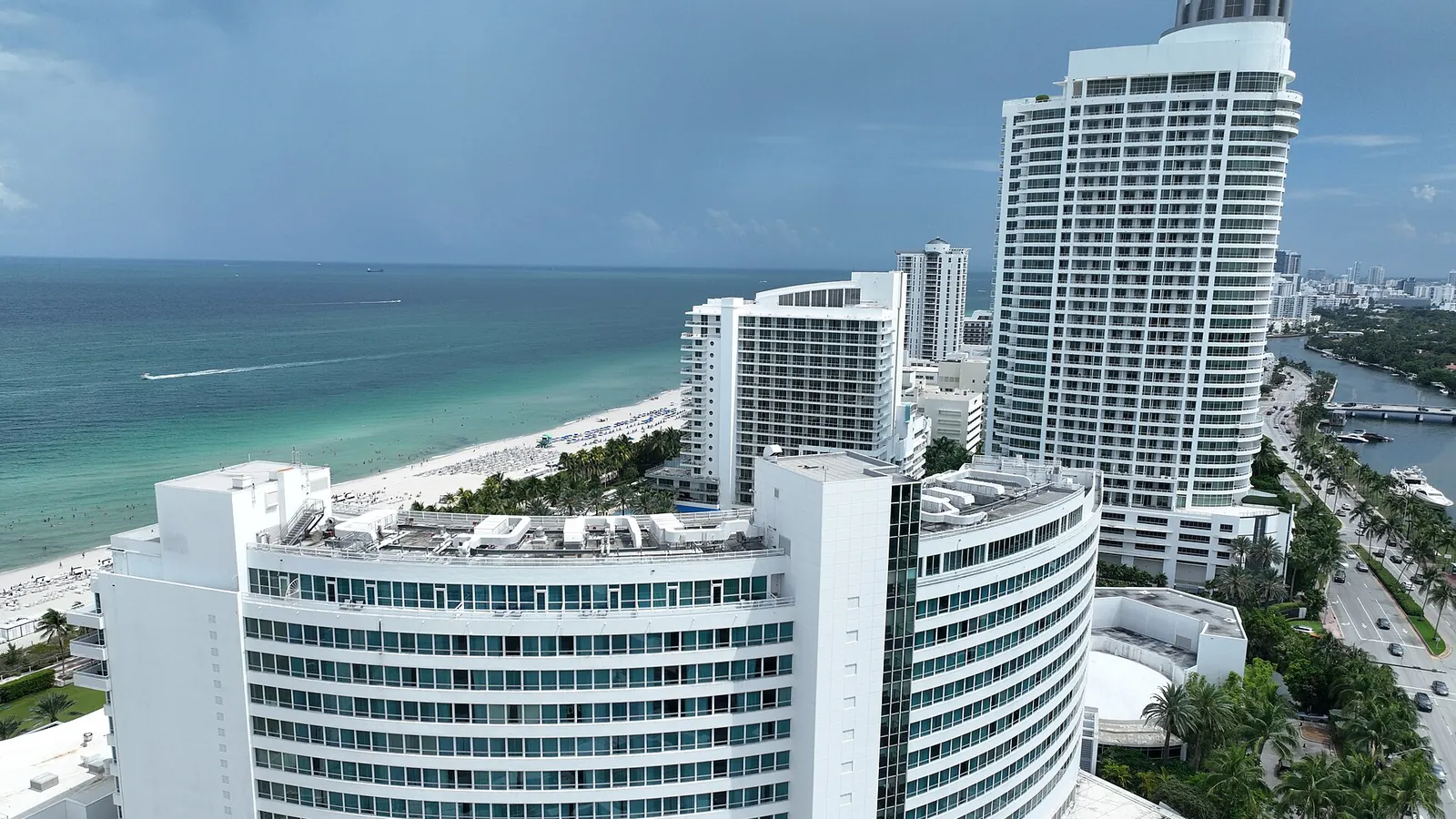
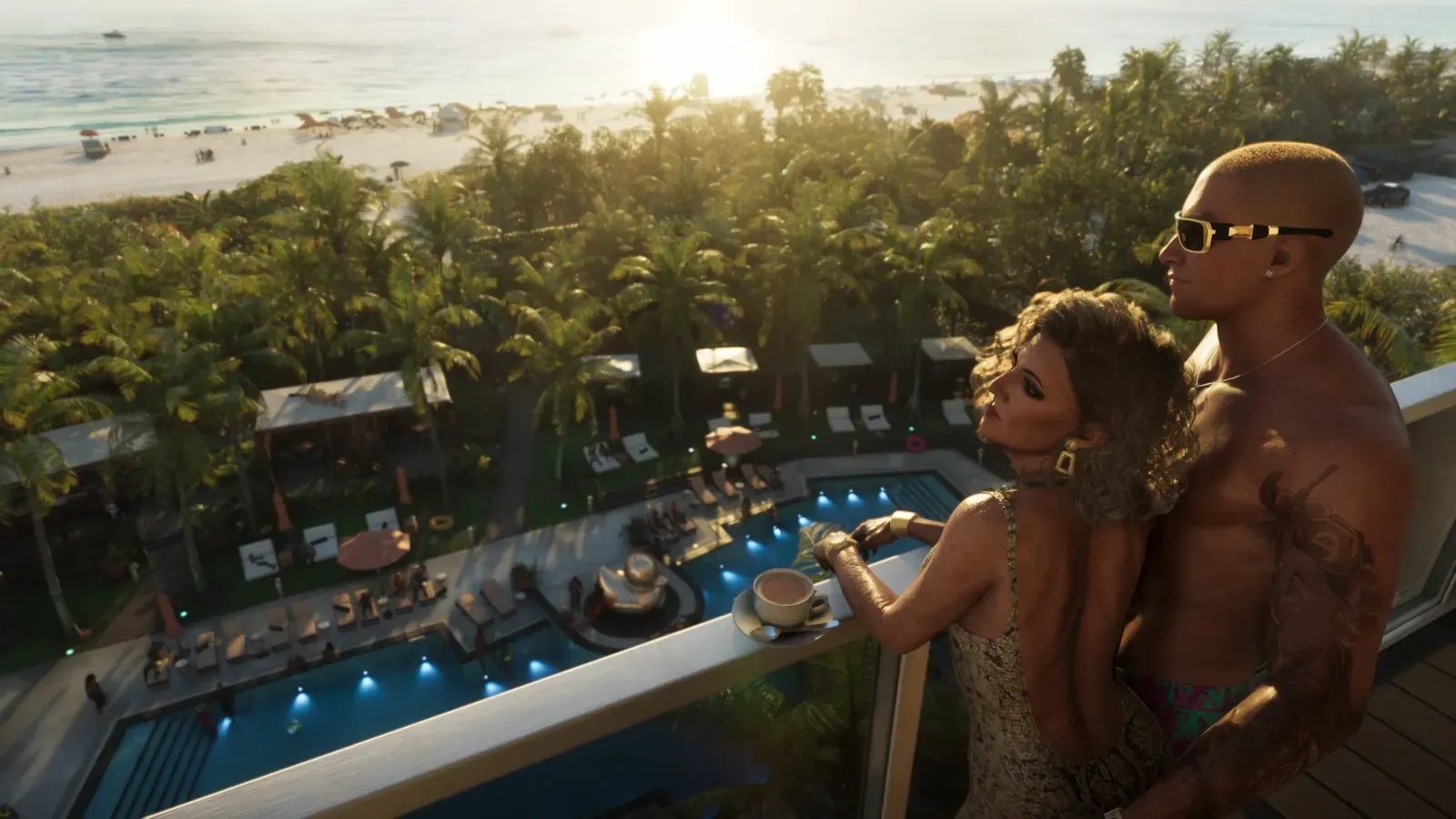
Beachfront pool deckFontainebleau Miami Beach
4401 Collins Avenue, Miami Beach
Fontainebleau is a legendary 1954 Miami Beach hotel, famed for its curved facade. Perched atop the Trésor Tower is a penthouse complete with a private pool and terrace.
Rockstar's TakeAccording to the Miami New Times, the trailer shot featuring the terrace and pool is modeled directly on the Trésor Tower penthouse balcony. The hotel's name doesn't appear in-game - leaving just the beach view and palm-lined garden.
Confirmation: Miami New Times.

Left: Artwork: Rockstar Games. Right: Photo: P. Hughes, CC BY-SA 4.0, Wikimedia Commons.
04Vice City
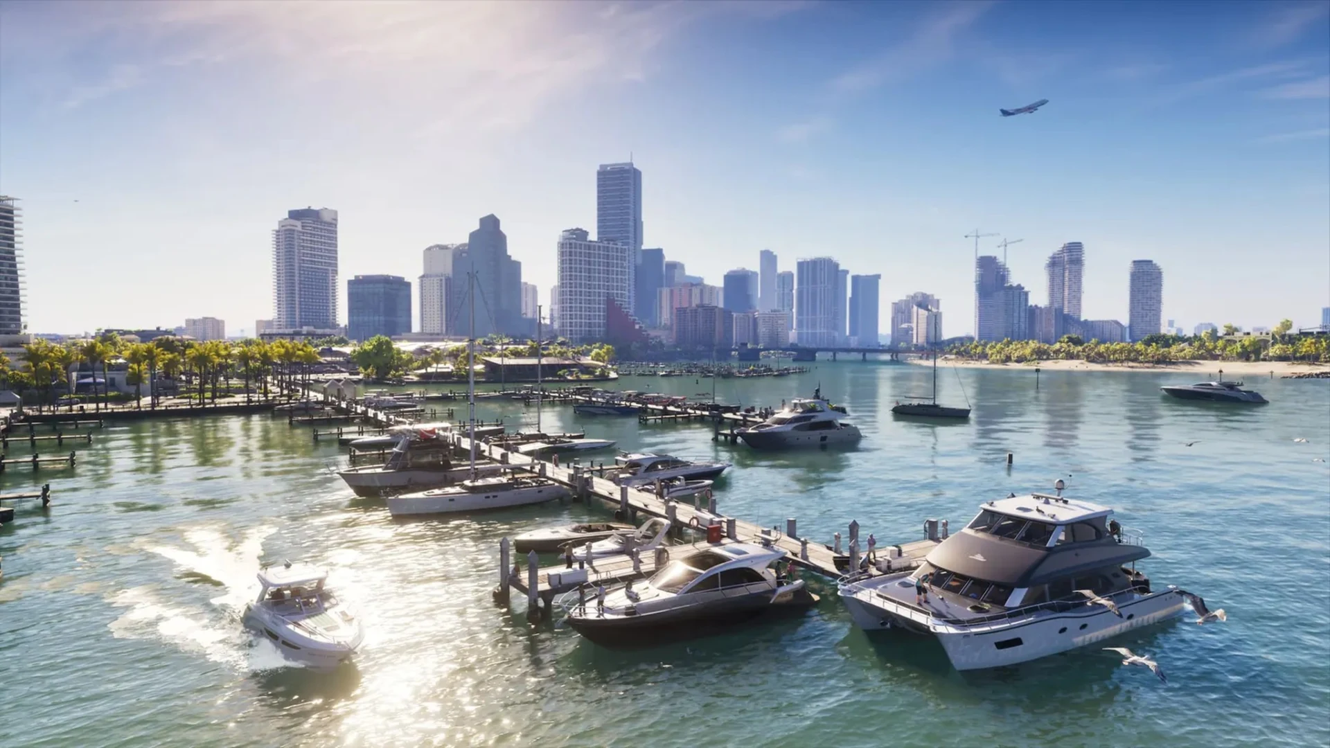
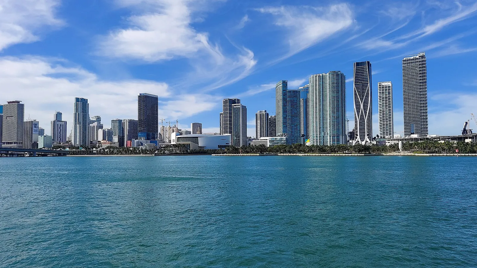
Vice City skylineDowntown Miami
View from Biscayne Bay
Downtown Miami sits directly on Biscayne Bay. Its wall of glass skyscrapers is best viewed from the water or the causeways leading to Miami Beach.
Rockstar's TakeVice City mirrors this layout: a waterfront skyline, with marinas and speedboats in the foreground. Some buildings are faithfully recreated, while others are fictionalized or rearranged.
Confirmation: GTABase, Miami New Times.
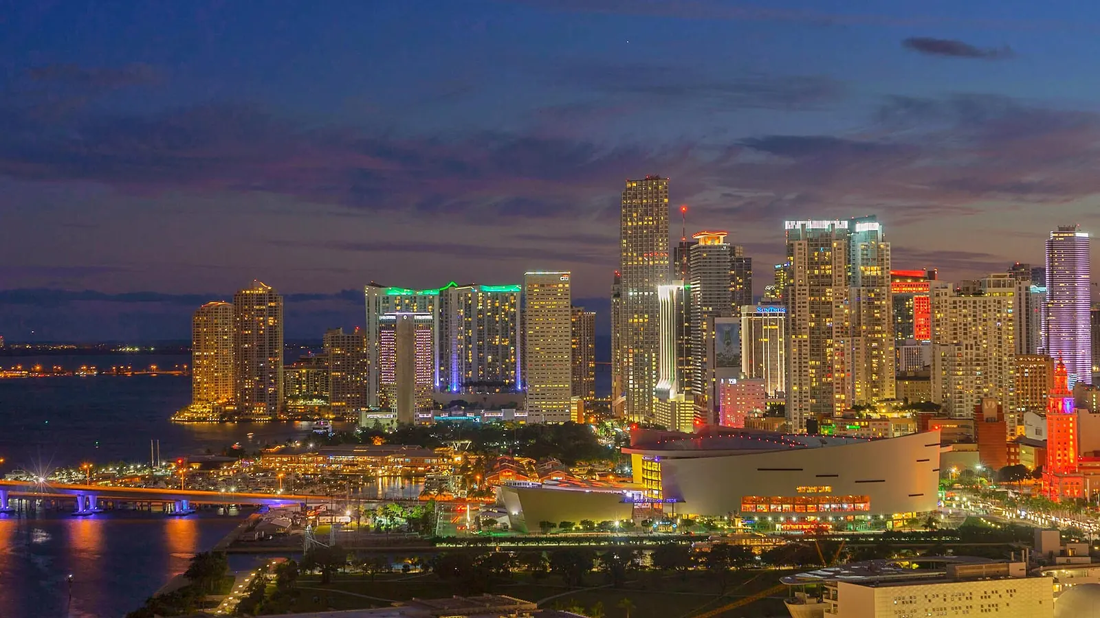
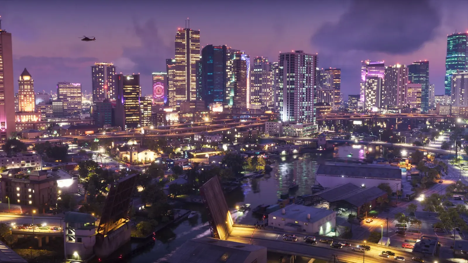
Left: Artwork: Rockstar Games. Right: Photo: alyssa BLACK., CC BY-SA 2.0, Wikimedia Commons.
05Vice City
Vice City at nightBrickell and Downtown Miami at night
Brickell, Miami
Brickell is Miami's financial district south of the river. At night, its skyscrapers light up with vibrant illuminations.
Rockstar's TakeRockstar faithfully modeled specific buildings from the area. The Miami New Times notes landmarks like Brickell on the River and the 500 Brickell twin towers with their circular cutout. The in-game palette is dialed up, heavy on pinks and purples.
Confirmation: Miami New Times.
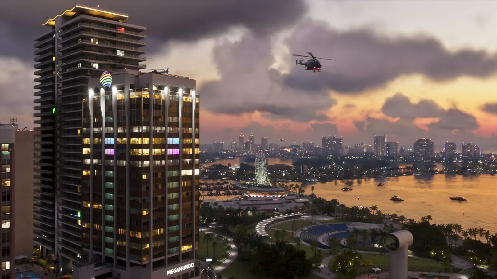
Left: Artwork: Rockstar Games. Right: Photo: Chris6d, CC BY-SA 4.0, Wikimedia Commons.
06Vice City
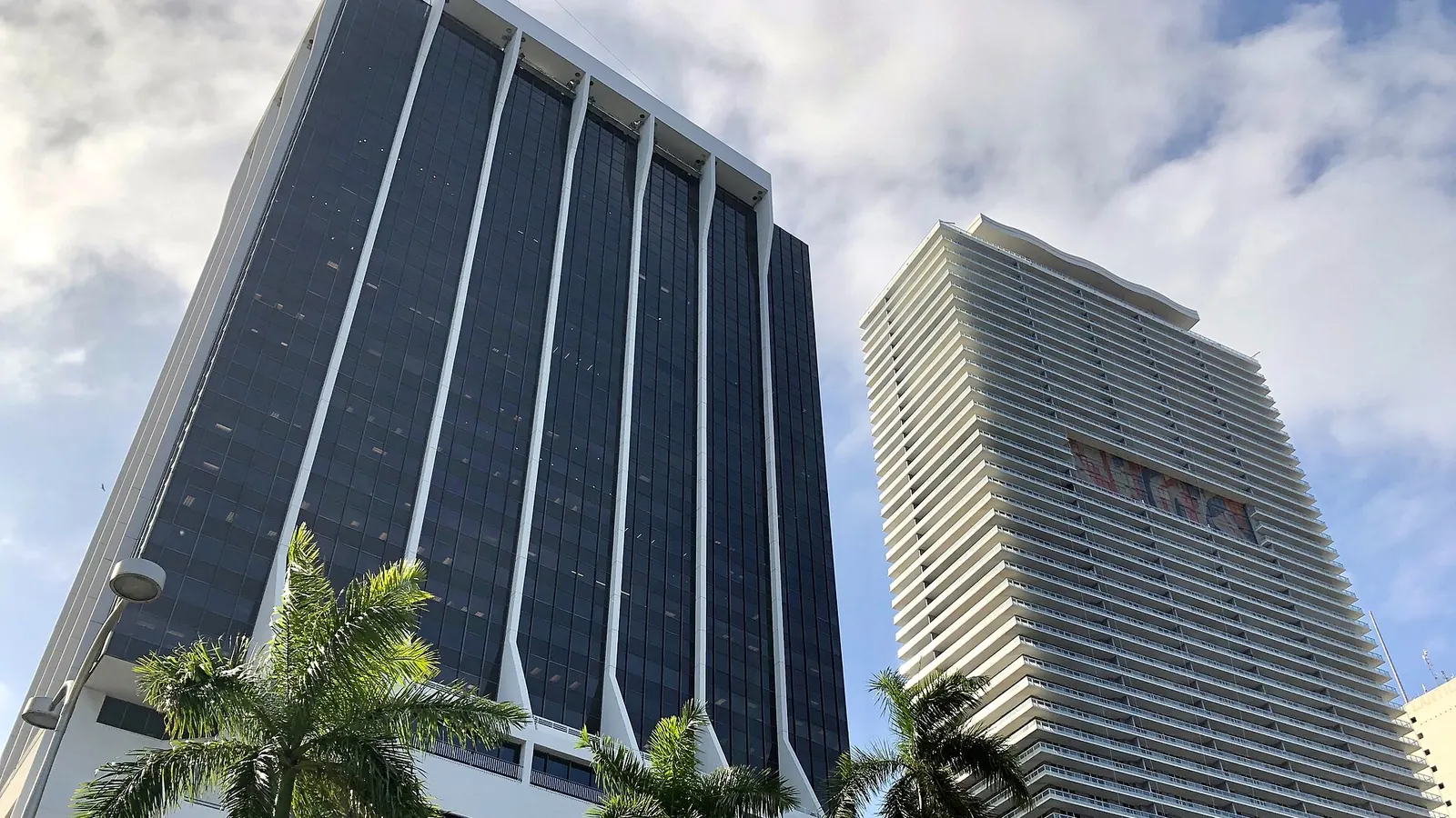
Megamundo skyscraperOne Biscayne Tower
2 South Biscayne Boulevard, Miami
One Biscayne Tower is a 1970s office high-rise on Biscayne Boulevard. It is easily recognized by its dark glass and pale vertical columns that flare out at the base.
Rockstar's TakeIn-game, this structure houses Megamundo, a fictional Spanish-language TV network. It's Rockstar's satirical nod to Miami's Latino broadcasters - the real tower is merely a standard office building.
Confirmation: GTABase.

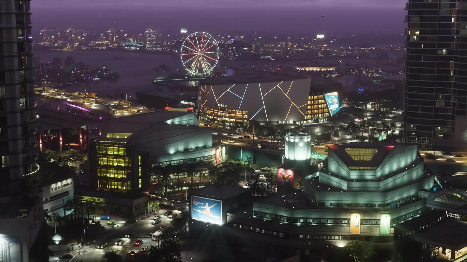
Left: Artwork: Rockstar Games. Right: Photo: B137, CC BY-SA 4.0, Wikimedia Commons.
07Vice City
Sahara Arena and Ferris wheelKaseya Center and Skyviews Miami
601 Biscayne Boulevard, Miami
Kaseya Center (formerly American Airlines Arena) is the Miami Heat's waterfront basketball arena. Right next door at Bayside Marketplace sits the Skyviews Miami observation wheel.
Rockstar's TakeIn Vice City, the venue is called the Sahara Arena, home to the Vice City Narcos. The Ferris wheel is also present, currently unnamed. Rockstar repositioned the landmarks to fit both into a single shot.
Confirmation: GTABase.
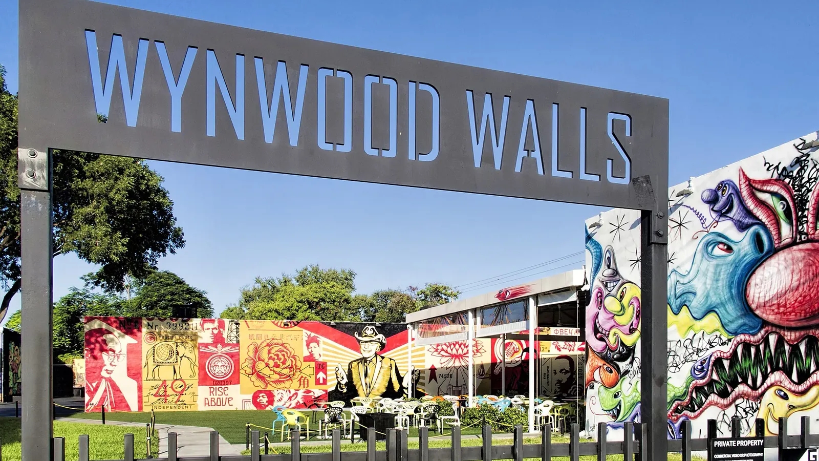
Left: Artwork: Rockstar Games. Right: Photo: Dan Lundberg, CC BY-SA 2.0, Wikimedia Commons.
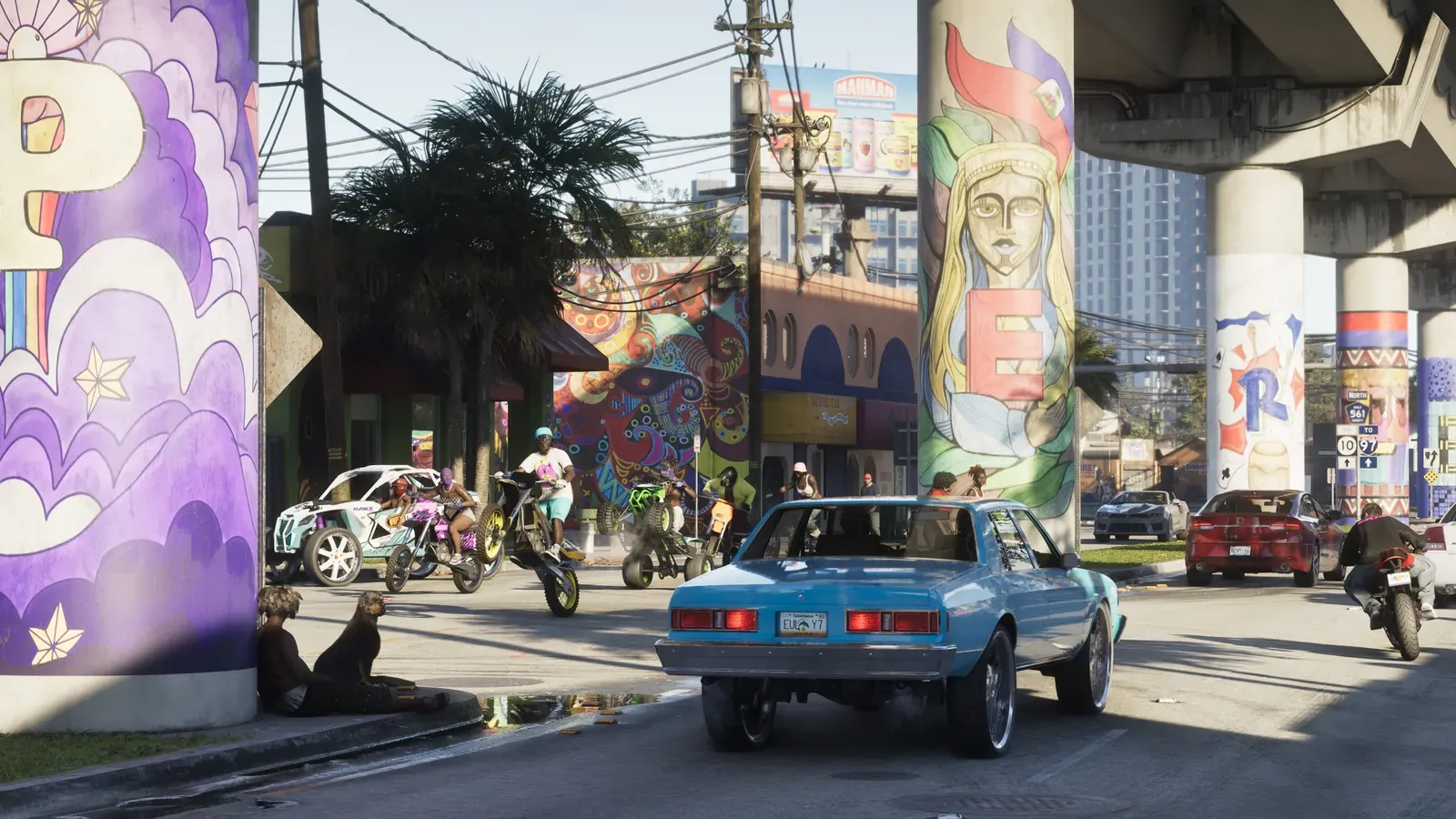
08Vice City
Stockyards muralsWynwood Walls
2516 NW 2nd Avenue, Miami
Wynwood is a former warehouse district turned open-air gallery by street art. At its heart lies Wynwood Walls - a courtyard showcasing murals by artists from across the globe.
Rockstar's TakeIn-game, these murals appear in the Stockyards district. The street and warehouse layout mirrors industrial Allapattah, while the art and tags are lifted straight from Wynwood. The Miami New Times spotted real local artists' tags in the trailer.
Confirmation: Miami New Times, GTABase.
Left: Artwork: Rockstar Games. Right: Photo: Phillip Pessar, CC BY 2.0, Wikimedia Commons.
09Vice City
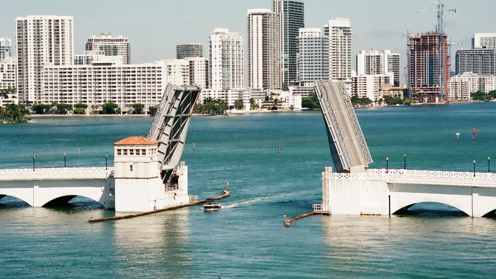
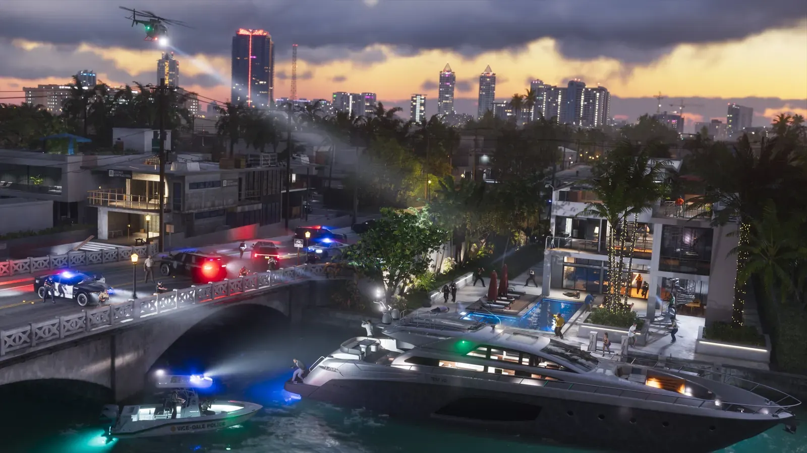
Mansion islandsVenetian Islands and Venetian Causeway
Venetian Way, between Miami and Miami Beach
The Venetian Causeway is a historic low-bridge route linking Miami to Miami Beach across a chain of man-made islands. The islands are lined with luxury waterfront homes featuring private docks.
Rockstar's TakeThe Miami New Times notes that the causeway and the Venetian Isle condominiums at 1000 Venetian Way are faithfully recreated in-game. An official still shows the same setting: a low bridge with white railings, a canal, and villas flanked by yachts.
Confirmation: Miami New Times.
Left: Artwork: Rockstar Games. Right: Photo: Quintin Soloviev, CC BY 4.0, Wikimedia Commons.
10Vice City
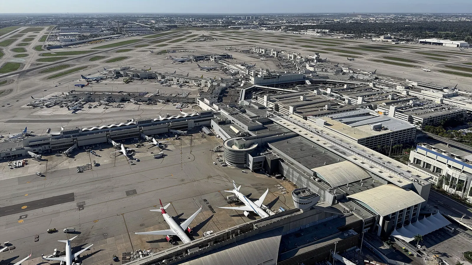
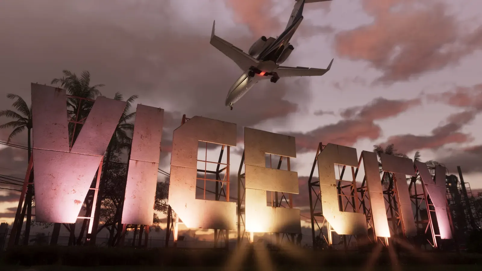
VCIA AirportMiami International Airport
MIA Airport, West Miami
Miami International Airport is South Florida's primary airport, located a few miles west of Downtown.
Rockstar's TakeVice City International Airport is modeled on MIA, sharing features like its air traffic control tower. The giant city name sign doesn't exist at the real Miami airport - that's a Rockstar addition.
Confirmation: GTABase.
Leonida Keys
Florida Keys - 3 Pairs
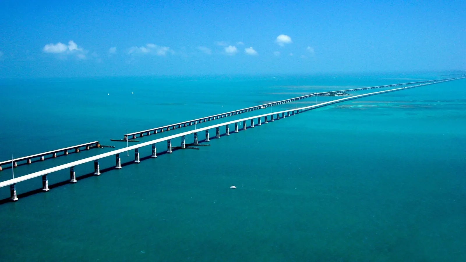
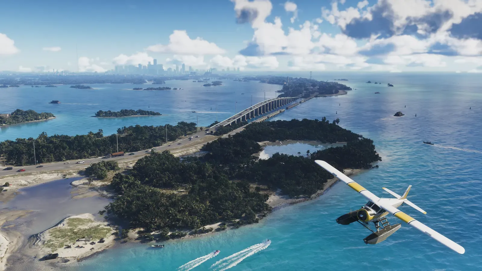
Left: Artwork: Rockstar Games. Right: Photo: U.S. Department of Transportation, public domain, via Wikimedia Commons.
11Leonida Keys
Leonida Keys bridgeSeven Mile Bridge
Overseas Highway, between Marathon and Little Duck Key
The Seven Mile Bridge spans nearly 7 miles (11 km), connecting the Middle Keys to the Lower Keys. It is the most famous stretch of road to Key West and one of the longest bridges in the US.
Rockstar's TakeThe trailer's aerial shot mirrors the real-world view: a ribbon of highway over shallow, turquoise water. In-game, the archipelago is named the Leonida Keys and is noticeably more compact, so the bridge reaches the next island much sooner.
Confirmation: Miami New Times, GTABase.
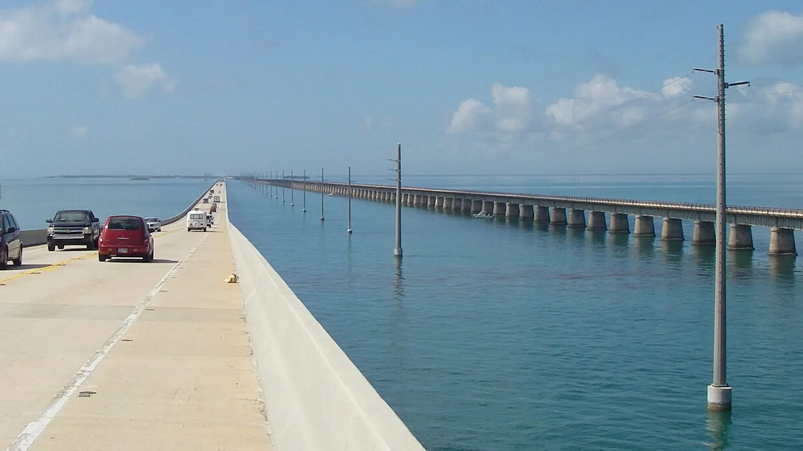
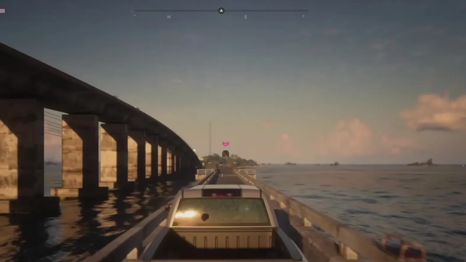
Left: In-game capture - Xbox Series X. Right: photo by Lightenoughtotravel, public domain, via Wikimedia Commons.
12Leonida Keys
Island highwayOverseas Highway and historic railway bridges
U.S. Route 1, Florida Keys
The Overseas Highway follows the route of Henry Flagler's overseas railroad, completed to Key West in 1912. Alongside today's modern spans, sections of the abandoned historic bridge still stand, repurposed as fishing piers and walking trails.
Rockstar's TakeThe Leonida Keys feature the exact same setup: cruise along the new highway while the derelict old span parallels your drive. One Chapter 1 mission even drops a joke about the bridge being unfinished.
Confirmation: GTABase.
Left: Artwork: Rockstar Games. Right: Photo: NOAA National Marine Sanctuaries, public domain, via Wikimedia Commons.
13Leonida Keys
Leonida Keys reefsFlorida Reef
John Pennekamp Coral Reef State Park, Key Largo
Running along the Keys is the Florida Reef, the only living barrier coral reef in the continental United States. John Pennekamp off Key Largo was the first underwater park in the US.
Rockstar's TakeRockstar turned the reef into a fully realized area of the map: scuba dive, explore shipwrecks, and scan marine life for your compendium. The name Key Lento also appears to be a play on Key Largo: largo and lento are both musical terms for slow tempos.
Confirmation: GTABase, Rockstar Games.
The rest of Leonida
Everglades, Clewiston, Panhandle, and Georgia - 4 pairs

Left: Artwork: Rockstar Games. Right: Photo: Cacophony, CC BY 2.5, via Wikimedia Commons.
14The rest of Leonida
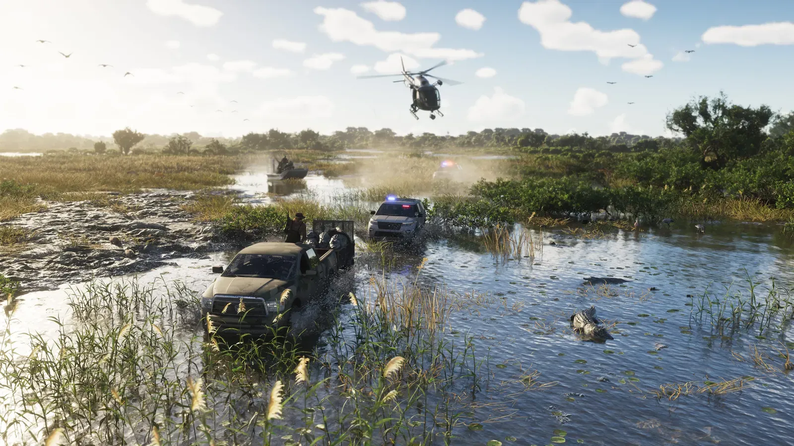
GrassriversEverglades
wetlands west of Miami
The Everglades are vast, shallow sawgrass wetlands stretching out just past Miami's western suburbs, famously explored via flat-bottomed airboats driven by giant aircraft props. Ever since Marjory Stoneman Douglas's 1947 book, they have been known as the River of Grass.
Rockstar's TakeThe in-game name Grassrivers is practically an inversion of River of Grass. It features the same prop-driven airboats, alligators, and stilt shacks, with the Vice City skyline rising in the distance - just like Miami viewed from the Glades.
Confirmation: GTABase, Rockstar Games.
Left: Artwork: Rockstar Games. Right: Photo: Fred Ward / U.S. National Archives, public domain, via Wikimedia Commons.
15The rest of Leonida
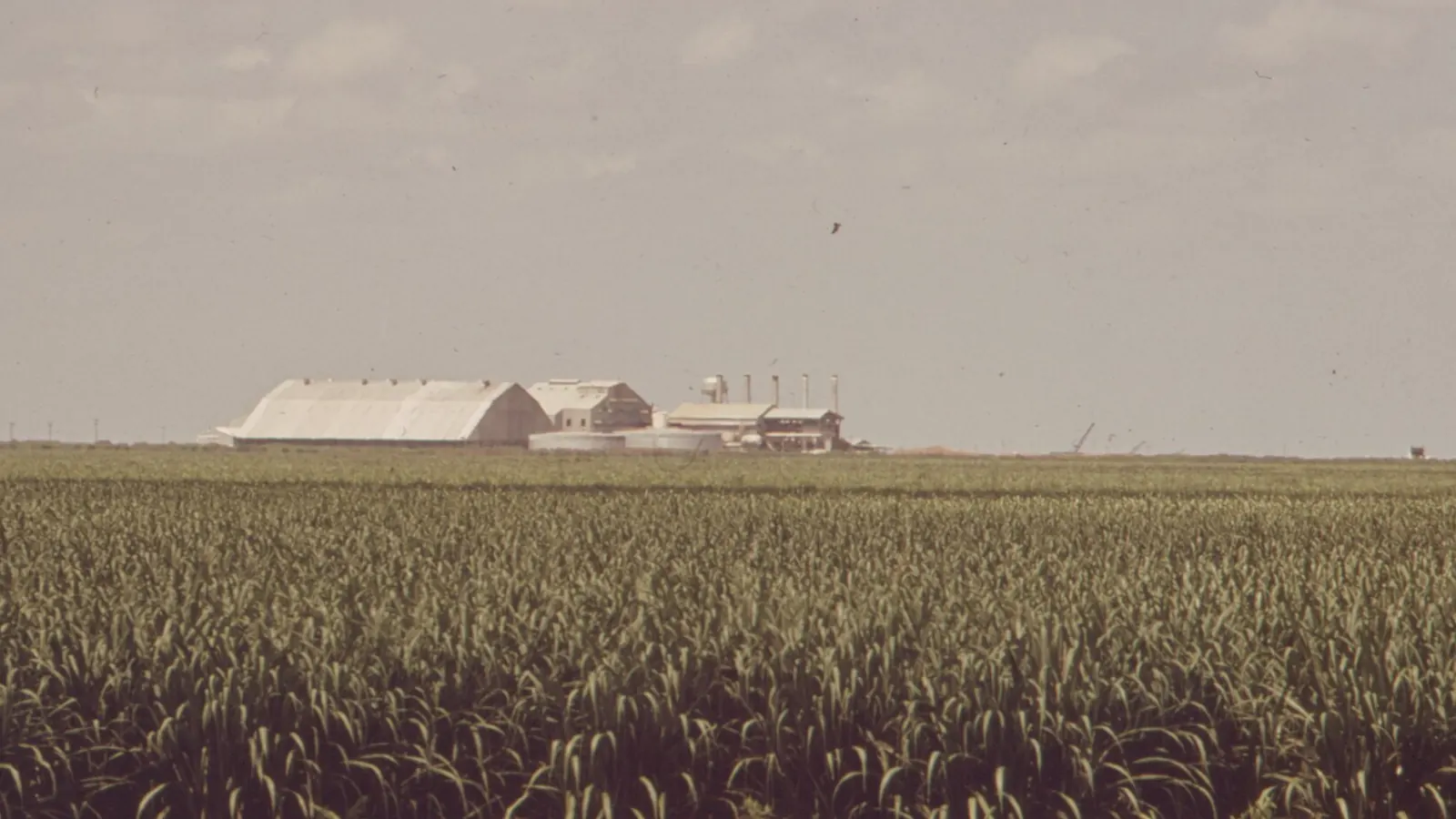
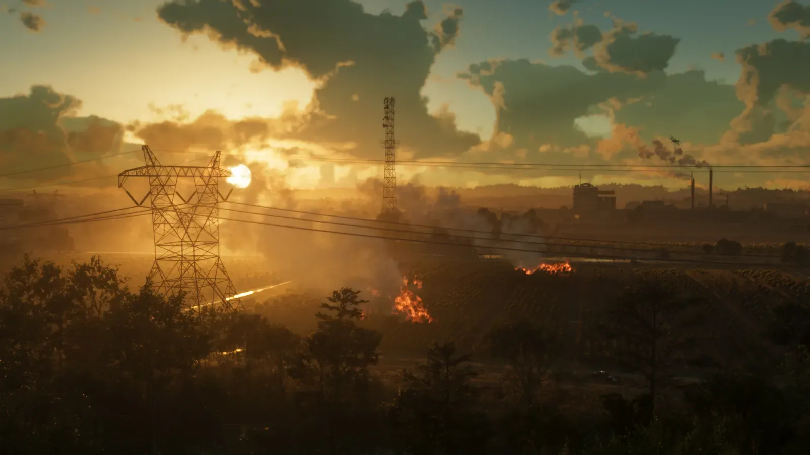
Ambrosia and the Allied Crystal refineryClewiston and the U.S. Sugar refinery
Clewiston, southern shore of Lake Okeechobee
Perched on the southern shore of Lake Okeechobee, Clewiston calls itself America's Sweetest Town. The town's economy revolves around sugarcane and the massive processing mill run by the U.S. Sugar Corporation. In autumn and winter, the cane fields are burned before harvest.
Rockstar's TakeAmbrosia mirrors this: the Allied Crystal refinery, the local motto Keeping Leonida Sweet, and controlled burns lighting up the horizon. Rockstar also threw in an outlaw motorcycle club, which the official background lore describes as running the rest of town.
Allied Crystal Refinery on map
Confirmation: GTABase, Rockstar Games.
Left: Artwork: Rockstar Games. Right: Photo: Iscream icecream, CC0, via Wikimedia Commons.
16The rest of Leonida
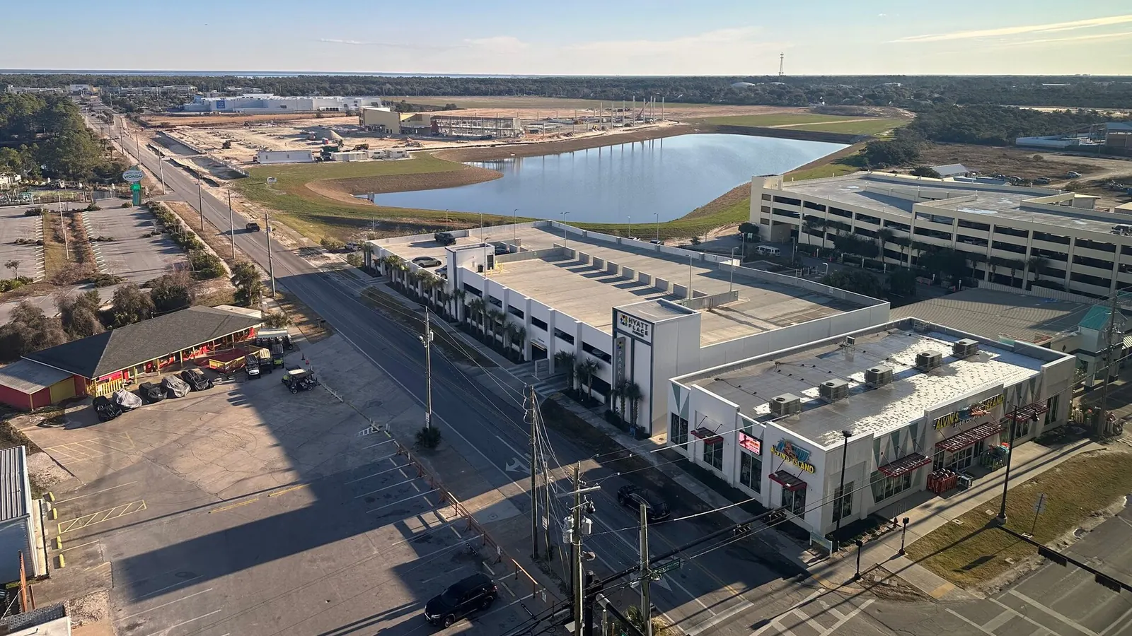
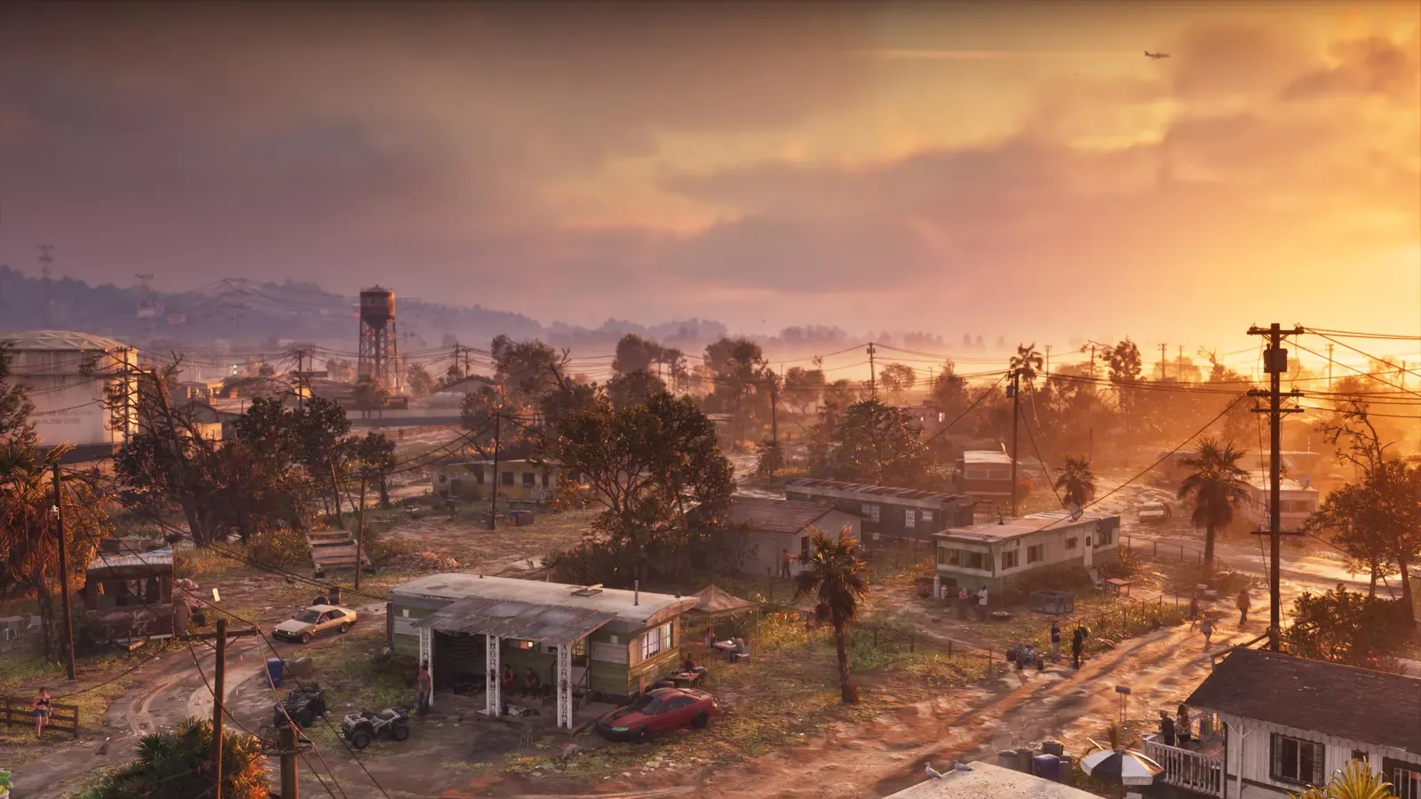
Port GellhornPanama City and the Panhandle coast
Panama City, Northwest Florida
The Florida Panhandle is a narrow strip along the Gulf of Mexico in Northwest Florida, sharing far more cultural DNA with Alabama than Miami. The stretch of coastline east of Panama City actively brands itself as the Forgotten Coast.
Rockstar's TakeRockstar's official description dubs Port Gellhorn the forgotten coast of Leonida: budget motels, shuttered tourist traps, and dead strip malls. GTABase links the town to Panama City, while the Port Gellhorn International Raceway draws clear inspiration from Sebring.
Confirmation: GTABase, Rockstar Games.
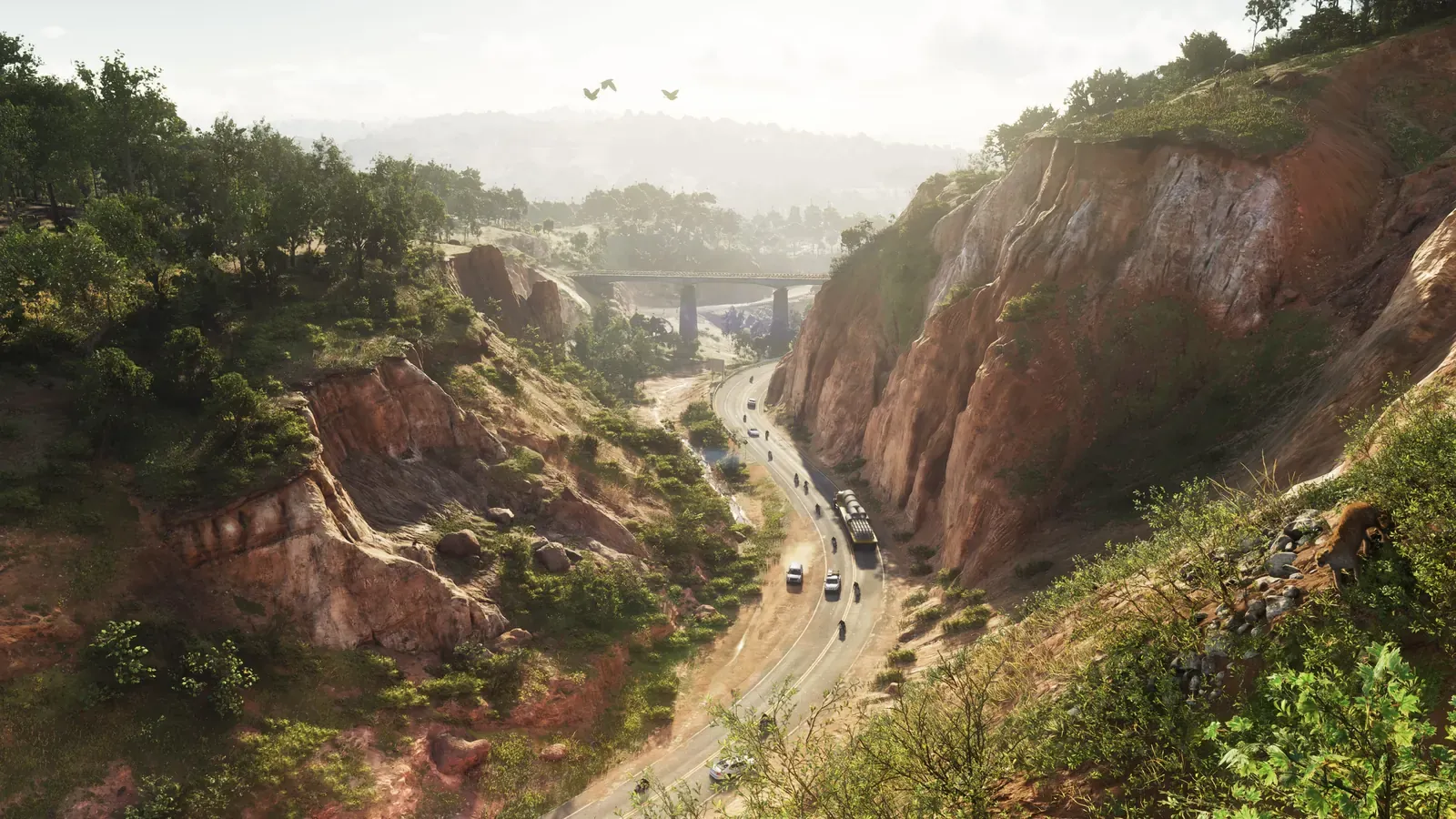
Left: Artwork: Rockstar Games. Right: Photo: Robbie Honerkamp, CC BY-SA 3.0, via Wikimedia Commons.
17The rest of Leonidaleast certain match
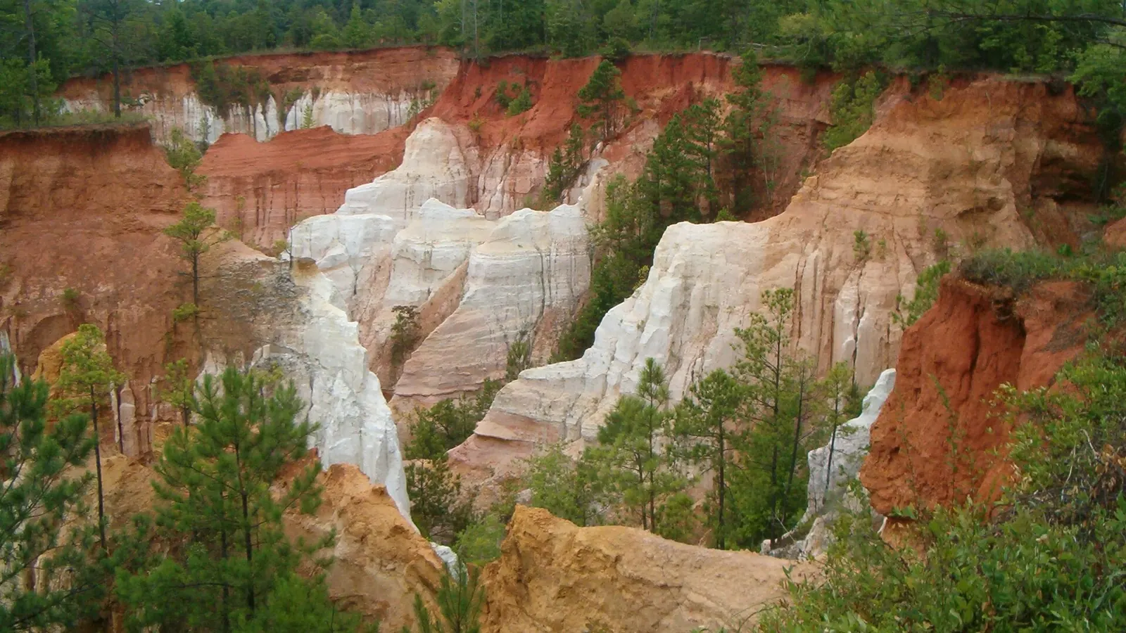
Mount Kalaga National ParkProvidence Canyon
Lumpkin, Georgia
Florida is flat, so the mountains in the north of the map must come from somewhere else. Providence Canyon in neighboring Georgia features gullies with red, orange, and white walls, often called the Little Grand Canyon.
Rockstar's TakeThe canyon seen in official Mount Kalaga screenshots shares the same soil color and rim pines. It's the least certain match in the lineup: GTABase notes that the in-game park is much larger and wilder, while fans are still debating the peak itself.
Confirmation: GTABase.
Frequently asked questions
Where should I start in Miami Beach?
Open the Ocean Drive pair to compare the street frontage and the hotels. Then open South Beach for the beach and lifeguard towers.
Are the places reproduced exactly?
The comparisons show visual similarities. The notes distinguish close matches from looser parallels, especially around Mount Kalaga.
Next guide · GTA 6 review: Jason, Lucia and life beyond Vice City